


The Most Important Shipping Routes In The World
Synopsis: Global trade relies heavily on a few narrow maritime corridors that connect major oceans and shorten shipping distances between continents. These routes carry enormous volumes of oil, goods, and raw materials every day. Any disruption in these strategic passages can quickly affect supply chains, energy markets, shipping costs, and the stability of the global […] The post The Most Important Shipping Routes In The World appeared first on Trade Brains.
Synopsis: Global trade relies heavily on a few narrow maritime corridors that connect major oceans and shorten shipping distances between continents. These routes carry enormous volumes of oil, goods, and raw materials every day. Any disruption in these strategic passages can quickly affect supply chains, energy markets, shipping costs, and the stability of the global economy.
Global trade moves mostly by sea, and a handful of narrow waterways quietly carry a massive share of the world’s energy, goods, and raw materials. These maritime chokepoints connect major oceans, shorten shipping distances, and keep supply chains moving between continents. When even one of these routes faces disruption, the impact can ripple through global markets.
Recent tensions around Iran and the Strait of Hormuz, for example, have once again highlighted how vulnerable the world economy can be to instability in these critical corridors. From oil flows and manufactured goods to food and minerals, some shipping routes have become so essential that the modern global economy depends on them. Here are five of the most important shipping routes in the world.

Strait of Hormuz – Oil lifeline of the world
According to an article from BBC, the Strait of Hormuz is one of the most important shipping routes in the world and the most critical oil transit choke point. It lies between Iran in the north and Oman and the United Arab Emirates (UAE) in the south. The corridor connects the Persian Gulf to the Arabian Sea. The strait is about 50 km (31 miles) wide at its entrance and exit, and narrows to about 33 km at its tightest point. It is deep enough for the world’s largest crude oil tankers and is heavily used by major oil and gas producers in the Middle East as well as their global customers.
In 2025, around 20 million barrels of oil moved through the Strait of Hormuz every day, according to estimates from the US Energy Information Administration (EIA). This represents nearly USD 600 billion (GBP 447 billion) worth of energy trade each year. The oil transported through the route comes not only from Iran but also from other Gulf countries including Iraq, Kuwait, Qatar, Saudi Arabia and the UAE.

The strait also provides the only sea route from the Persian Gulf to the open ocean. This role has existed for centuries because the surrounding regions had valuable trade goods but lacked direct access to major trading ports. In his memoirs, Babur, the first padishah of the Mughal Empire, described how almonds from the Ferghana region in Central Asia had to be transported to Hormuz before reaching international markets.
To reduce the risk of ship collisions, vessels passing through the strait follow a traffic separation scheme (TSS). Ships entering the gulf use one lane while ships leaving use another. Each lane is two miles wide and they are divided by a two-mile-wide median strip. If shipping through the Strait of Hormuz were seriously disrupted for a long period, it could trigger a major oil supply crisis for large Asian importers such as India and China.
Strait of Malacca – Asia’s trade artery
According to a report from Britannica, The Strait of Malacca is one of the most important maritime routes in the world because it connects the Indian Ocean with the Pacific Ocean. According to a report from Britannica, the waterway links the Andaman Sea with the South China Sea and runs between the Indonesian island of Sumatra to the west and Peninsular Malaysia and southern Thailand to the east.
The strait stretches for about 500 miles (800 km) and covers roughly 25,000 square miles (65,000 square km). It is funnel-shaped, about 40 miles (65 km) wide in the south and expanding to nearly 155 miles (250 km) toward the north between We Island and the Isthmus of Kra. The strait is named after the historic trading port of Melaka, which was an important commercial hub during the 16th and 17th centuries. Depths in the southern section usually range between 90 and 120 feet and gradually deepen to around 650 feet toward the northwest where the strait merges with the Andaman Basin. Navigation is also complicated by small islands, reefs, and sand ridges formed by sediments carried by rivers from Sumatra.

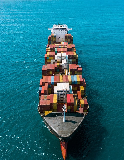
As the main shipping channel between the Indian and Pacific oceans, the Strait of Malacca has become one of the busiest trade routes on the planet. More than 94,000 vessels pass through the strait each year, carrying about 25 percent of the world’s traded goods including oil, Chinese manufactured products, coal, palm oil, and Indonesian coffee. Estimates suggest that roughly 35 percent of seaborne oil and about 20 percent of global gas shipments move through this corridor. The strait also connects many of Asia’s largest economies including India, Thailand, Indonesia, Malaysia, the Philippines, Singapore, Vietnam, China, Japan, Taiwan, and South Korea, and forms part of the Maritime Silk Road linking East Asia with India, Africa, and Europe through routes that pass the Red Sea and the Suez Canal.
Despite its importance, it is also one of the world’s most congested shipping chokepoints and narrows to only about 2.8 kilometers at the Phillip Channel near Singapore. The shallowest depth in the Singapore Strait is around 25 metres, which limits the size of ships that can pass. The largest vessels able to use this route are known as Malaccamax ships, while larger vessels must take longer detours through passages such as the Sunda Strait, Lombok Strait, Makassar Strait, Sibutu Passage, and the Mindoro Strait.
Suez Canal – Europe-Asia shortcut
The Suez Canal is one of the most important artificial waterways in the world because it connects the Mediterranean Sea with the Red Sea and provides the shortest maritime route between Europe and the regions around the Indian Ocean and western Pacific. According to an article from Britannica, the canal runs north to south across the Isthmus of Suez in Egypt and effectively separates the African continent from Asia. It stretches for about 193.3 kilometres (around 120 miles) and has become one of the busiest shipping lanes globally. The canal was built after French diplomat Ferdinand de Lesseps established the Compagnie de Suez in 1858 specifically to construct it. Construction began in 1859 and continued for a decade before the canal officially opened on 17 November 1869.
Today the canal is capable of handling large vessels with a draft of up to 20 metres and ships weighing as much as 240,000 deadweight tons, with height limits of around 68 metres above water and a maximum beam of 77.5 metres under certain conditions. These limits allow the canal to accommodate larger ships than the Panama Canal, as Suezmax dimensions exceed both Panamax and New Panamax standards.

Some of the largest supertankers are still too large to pass through, although they can sometimes offload part of their cargo onto canal-owned vessels to reduce their draft before continuing their journey. The canal now stretches close to 200 kilometres following several expansions and records more than 20,000 vessel crossings each year, including about 20,600 ships in 2021 alone, which averages roughly 56 vessels per day.
According to a report from the New Zealand Ministry of Foreign Affairs and Trade, there are currently no practical alternatives to the Suez Canal except sailing around the Cape of Good Hope at the southern tip of Africa, a detour that adds about 9,000 kilometres and increases travel time by roughly 6 to 14 days. In comparison, ships typically take only about 13 to 15 hours to transit the canal from one end to the other.

Satellite Image of Ever Given blocking the Suez Canal in March 2021
Bab el-Mandeb – Gateway to Suez
Bab el-Mandeb is a narrow but strategically vital strait that links the Red Sea with the Gulf of Aden and the wider Indian Ocean. The waterway lies between the Arabian Peninsula to the northeast and the Horn of Africa to the southwest and measures about 20 miles (32 km) across. The strait is divided into two separate channels by Perim Island, with the western channel about 16 miles (26 km) wide and the eastern channel roughly 2 miles (3 km) wide.
Its importance grew significantly after the opening of the Suez Canal in 1869, because it became a critical part of the maritime route connecting the Mediterranean Sea with East Asia. Water circulation between the Red Sea and the Gulf of Aden also flows through this passage since no such flow occurs through the Suez Canal. The Arabic name Bab el-Mandeb translates to “Gate of Tears,” a reference to the dangers that historically made navigation through the strait difficult.

Today the strait has become one of the world’s most important shipping chokepoints due to the large volume of energy and trade moving through it. According to multiple sources, around 3.3 million barrels of oil passed through the strait each day in 2006, rising to about 5.1 million barrels per day by 2014 and roughly 6.2 million barrels per day by 2018. In 2017 alone, total petroleum flows through the Bab el-Mandeb accounted for about 9 percent of global seaborne oil trade, with around 3.6 million barrels per day moving north toward Europe and about 2.6 million barrels per day flowing in the opposite direction toward Asian markets such as Singapore, China, and India.
Because of its importance, the region has also become a geopolitical hotspot. Several major powers, including the United States and China, maintain military bases in Djibouti to help secure the route. The strait is also a key corridor for undersea infrastructure, including power cables and fibre-optic communication lines, which are often monitored by intelligence agencies. Since the opening of the Suez Canal, control over the strait has been influenced by nearby territories including Yemen and Perim Island on the Arabian side and Djibouti, Eritrea, and the Seven Brothers Islands on the Horn of Africa, while naval activity continues between the Gulf of Aden and the Red Sea.
Panama Canal – Atlantic-Pacific connector
The Panama Canal is one of the most important engineering and shipping routes in the world because it connects the Atlantic and Pacific Oceans, allowing ships to avoid the long and dangerous journey around the southern tip of South America. According to an article from the Institut de relations internationales et stratégiques, the canal is a critical piece of infrastructure for global maritime trade, with roughly 5-6 percent of the world’s seaborne trade passing through it.
According to an article from the Institut de relations internationales et stratégiques, the canal helps transport a wide range of goods including manufactured products, hydrocarbons, minerals, and cereals. Located in Panama, the artificial waterway stretches about 82 kilometres (51 miles) and links the Caribbean Sea with the Pacific Ocean. The United States built the canal between 1904 and 1914 and administered it for most of the 20th century before transferring control to Panama in 1999 under the Torrijos-Carter Treaties signed in 1977. Today it is managed by the Panama Canal Authority, an autonomous organization separate from the Panamanian government.

The geography of the Isthmus of Panama requires ships to be lifted and lowered through a series of locks during transit. At each end of the canal, ships are raised to Gatun Lake, an artificial freshwater lake about 26 metres above sea level created by damming the Chagres River and Lake Alajuela, before being lowered again on the other side. The original locks, which are about 33.5 metres wide, were designed for Panamax ships, but a third wider lane of locks was built between 2007 and 2016 to allow larger Neopanamax vessels to pass through. Each ship transit uses around 200 million litres of fresh water, making the canal vulnerable during droughts.
Traffic through the canal has grown significantly over time, rising from about 1,000 ships in 1914 when it first opened to 14,702 vessels in 2008. By 2012, more than 815,000 ships had used the canal, and in 2023 it facilitated more than 14,000 transits while connecting nearly 2,000 ports in about 170 countries. Shipping volumes have also increased dramatically, from an estimated maximum capacity of 80 million tons per year in 1934 to about 340.8 million tons of cargo traffic in 2015. Despite this growth, the canal faces competition from alternative routes, with some analysts suggesting that rising toll costs and larger ships have made the Suez Canal a viable alternative for cargo traveling between Asia and the U.S. East Coast.

Disclaimer: The views and investment tips expressed by investment experts/broking houses/rating agencies on tradebrains.in are their own, and not that of the website or its management. Investing in equities poses a risk of financial losses. Investors must therefore exercise due caution while investing or trading in stocks. Trade Brains Technologies Private Limited or the author are not liable for any losses caused as a result of the decision based on this article. Please consult your investment advisor before investing.
The post The Most Important Shipping Routes In The World appeared first on Trade Brains.
What's Your Reaction?